
Seasoned Geomatics professional with 10+ years of experience in GIS, urban planning, and biodiversity conservation. As a Geospatial Data & GIS Expert at Naturalis, I specialize in translating complex spatial data into actionable insights for decision-makers. Using frameworks like TNFD and CSRD, I bridge the gap between technical analysis and sustainable policy. My mission is to empower stakeholders with clear, data-driven tools to build a resilient, sustainable future.
Keywords
Geomatics, GIS (Geographic Information Systems), Biodiversity Conservation, Ecosystem Services, Sustainability Reporting (CSRD/TNFD), Policy Advising, Urban Planning, Spatial Analysis, Disaster Risk Reduction (DRR), Data Visualization, Stakeholder Engagement, Natural Capital
Projectinterests
I am deeply passionate about empowering organizations through knowledge transfer and capacity building. With extensive experience, I have trained researchers, students, and decision-makers in GIS, Spatial Data Infrastructures (SDI), and risk management. I am particularly interested in projects that merge education with technical innovation. My goal is to transform complex spatial data into informed action. I seek impactful initiatives that foster sustainable development and global resilience by sharing expertise and building robust, data-driven networks that drive meaningful change.
Actueleonderwerpen
A selection of the topics I am working on currently:
- MAMBO Project: MODERN APPROACHES TO THE MONITORING OF BIODIVERSITY
Within this EU-wide initiative, I bridge critical knowledge gaps in nature conservation. I developed frameworks and tools to optimally position and link the MAMBO tools under development to the Research Infrastructures (RIs) landscape and the Knowledge Centre on Biodiversity (KCBD) and its technical implementation of tools and technology supporting EU Pollinator, translating insights from European stakeholders and decision-makers into practical, data-driven solutions for biodiversity monitoring.
- Green Circles: Living Lab Alblasserwaard
In the Alblasserwaard region, I create "opportunity maps" that identify key areas for nature restoration. Using GIS-based solutions, I map out ecosystem services to support urban green space development and enhance the quality of the local environment.
- THRIVE: Natural Capital & Sustainability
As part of the Natural Capital Team, I help organizations navigate new sustainability reporting standards (such as CSRD). I manage a comprehensive database of geo-referenced data and location-specific maps, enabling companies to clearly visualize their environmental impact and align their strategy with global sustainability goals.
- Commit2Green
- Biodiversity Risk Assessments
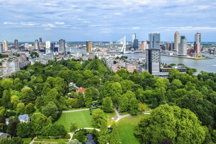
- Rotterdam Biodiversity Monitoring Network

Commit2Green

THRIVE Toolset for Hierarchical Reporting and Insightful Validation of Ecosystems
Green Circles